The Seven Rila Lakes
Presentation
Work time
How do we get to
Service
Practical information
Information Center
Contacts
The Seven Rila Lakes are without a doubt one of the most notable natural attractions on the Balkan Peninsula, a dream destination not to be missed. Their beauty touches the thousands of Bulgarian and international visitors who visit them.
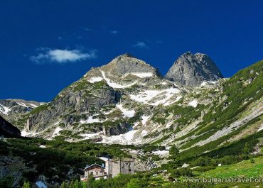
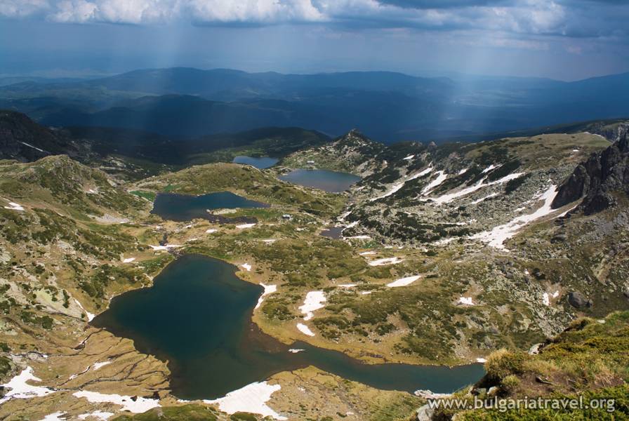
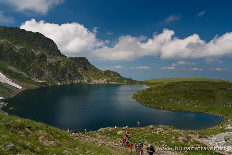
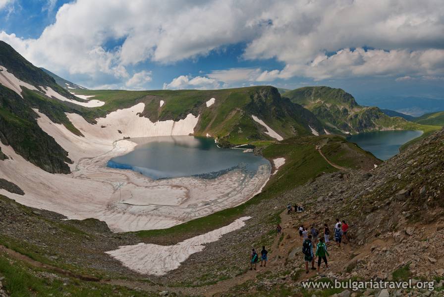
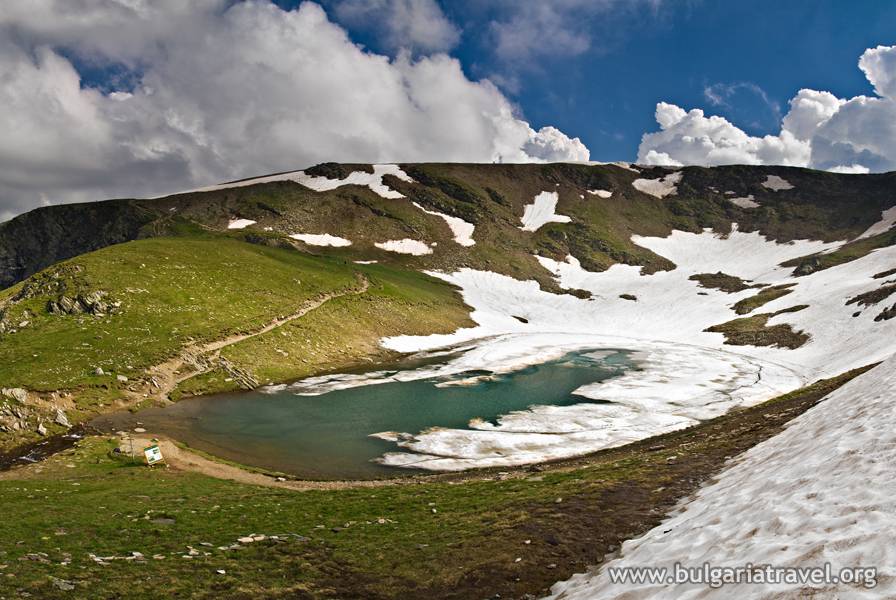
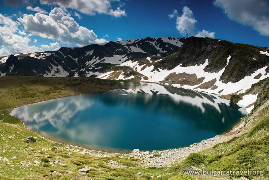
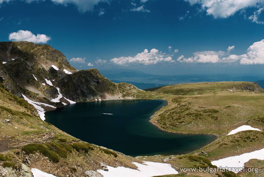
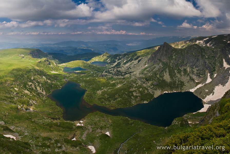
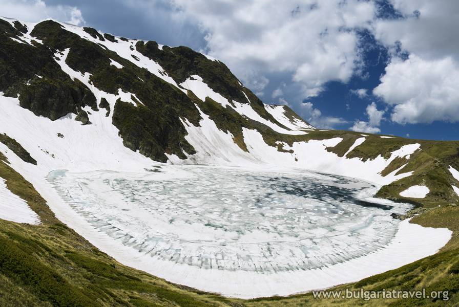
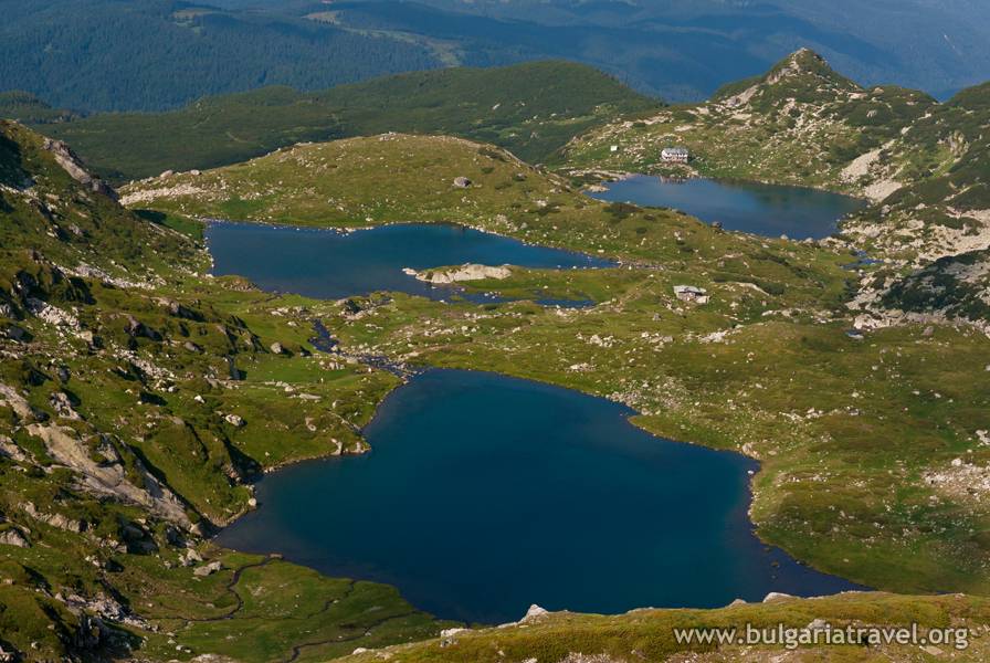
The Seven Rila Lakes, located in the Dangskiya region of the northwestern Rila Mountains, are glacial lakes. They are scattered at the foot of a massive cirque that includes the peaks Suhi Chal (Dry Peak), Otovishki, and Haramiya. The lakes have been named for their shapes and qualities. The highest of them is Tear Lake, which gained its name for its crystal-clear water. It is 2,535 meters high, directly beneath the Otovishki Peak. Next is Eye Lake, the deepest of the seven at 37.5 meters. It is oval and
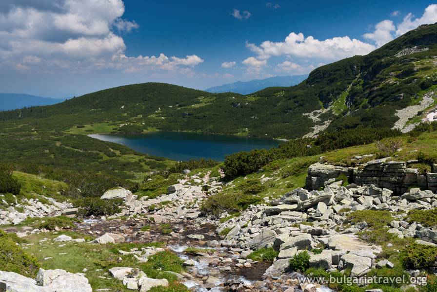
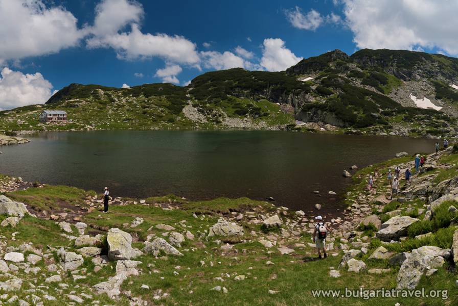
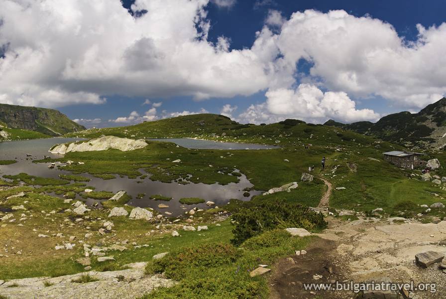
intense blue when the weather is good. Divers have explored this lake to gain further information about it. Somewhat lower than Eye Lake is Kidney Lake, named for its kidney shape, which has a surface area of 85 hectares and steep rocky banks. Next comes the Twins. Wide at both ends and narrow in the middle the lake resembles an hourglass. During dry years, the lake transforms into two smaller ones, and this is the source of its name. Farther down the trail are Three-leafed Lake and Fish Lake. The Seven Lakes Shelter is on the banks of Fish Lake. The lowest lake is appropriately called Lower Lake, which feeds the Dzherman River. The lakes are all connected by narrow streams.
Fish live in some of the lakes – minnows and trout – but in general, these high mountain lakes are unsuitable habitat for marine life because of their frigid water temperature, fed by rain and snowmelt.
Every year on August 19, there is a large gathering of the White Brotherhood or Danovites, who congregate to celebrate their New Year. The celebration takes place near Kidney Lake and consists of ritual rhythmic unison dancing in a large circle. For the Danovites, the Rila Mountains are a holy place where thousands of devotees gather every year to greet the dawn.
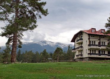
From the Panichishte Trailhead: Follow the trail markers from Panichishte to the lakes. At the Skakavitsa Shelter, about a kilometer from the Pioneer Shelter, take the narrow asphalt road to the right. Cars can travel this road as far as the Green Saddle area. From there follow the markers which lead to the Skakavitsa Shelter. Cross the river and follow the red markers toward the mountain peaks and to the Rila Lake Shelter. It is also possible to take a lift from the Pioneer Shelter after driving to the lower station of the lift near the shelter. The upper station is near the Rila Lakes Shelter, and from there it is a 1½-hour hike to the highest lake. There is also a hiking trail from the lower lift station.
From the Govedartsi Trailhead: There is a paved road to the Central Alpine Base Camp Malyovitsa. From there take the marked trail to the Malyovitsa Shelter, Malyovitsa Peak, and the Rila Lakes.
Suitable hiking boots are advised. Summer is the best season to visit the lakes. During the winter more serious mountain gear is needed, and the harsh conditions demand mountaineering training. Those who lack the necessary preparation should first contact an experienced guide or the information center.
Tourist information center – Sapareva Banya
Monday – Friday
8:00 – 17:00
Sapareva Banya 2650, Geyser area
Теl: +359 707/2 23 32
Е-mail: infcenter_sapb@abv.bg
Website:https://saparevabanya.bg/pages/mid/68/%D0%A2%D1%83%D1%80%D0%B8%D0%B7%D1%8A%D0%BC/%D0%98%D0%BD%D1%84%D0%BE%D1%80%D0%BC%D0%B0%D1%86%D0%B8%D0%BE%D0%BD%D0%B5%D0%BD-%D1%86%D0%B5%D0%BD%D1%82%D1%8A%D1%80.html
Websites:
www.rilanationalpark.bg
www.rilskiezera.bg
Presentation
The Seven Rila Lakes are without a doubt one of the most notable natural attractions on the Balkan Peninsula, a dream destination not to be missed. Their beauty touches the thousands of Bulgarian and international visitors who visit them.
The Seven Rila Lakes, located in the Dangskiya region of the northwestern Rila Mountains, are glacial lakes. They are scattered at the foot of a massive cirque that includes the peaks Suhi Chal (Dry Peak), Otovishki, and Haramiya. The lakes have been named for their shapes and qualities. The highest of them is Tear Lake, which gained its name for its crystal-clear water. It is 2,535 meters high, directly beneath the Otovishki Peak. Next is Eye Lake, the deepest of the seven at 37.5 meters. It is oval and
intense blue when the weather is good. Divers have explored this lake to gain further information about it. Somewhat lower than Eye Lake is Kidney Lake, named for its kidney shape, which has a surface area of 85 hectares and steep rocky banks. Next comes the Twins. Wide at both ends and narrow in the middle the lake resembles an hourglass. During dry years, the lake transforms into two smaller ones, and this is the source of its name. Farther down the trail are Three-leafed Lake and Fish Lake. The Seven Lakes Shelter is on the banks of Fish Lake. The lowest lake is appropriately called Lower Lake, which feeds the Dzherman River. The lakes are all connected by narrow streams.
Fish live in some of the lakes – minnows and trout – but in general, these high mountain lakes are unsuitable habitat for marine life because of their frigid water temperature, fed by rain and snowmelt.
Every year on August 19, there is a large gathering of the White Brotherhood or Danovites, who congregate to celebrate their New Year. The celebration takes place near Kidney Lake and consists of ritual rhythmic unison dancing in a large circle. For the Danovites, the Rila Mountains are a holy place where thousands of devotees gather every year to greet the dawn.
Work time
How to get there
From the Panichishte Trailhead: Follow the trail markers from Panichishte to the lakes. At the Skakavitsa Shelter, about a kilometer from the Pioneer Shelter, take the narrow asphalt road to the right. Cars can travel this road as far as the Green Saddle area. From there follow the markers which lead to the Skakavitsa Shelter. Cross the river and follow the red markers toward the mountain peaks and to the Rila Lake Shelter. It is also possible to take a lift from the Pioneer Shelter after driving to the lower station of the lift near the shelter. The upper station is near the Rila Lakes Shelter, and from there it is a 1½-hour hike to the highest lake. There is also a hiking trail from the lower lift station.
From the Govedartsi Trailhead: There is a paved road to the Central Alpine Base Camp Malyovitsa. From there take the marked trail to the Malyovitsa Shelter, Malyovitsa Peak, and the Rila Lakes.
Servising
Practical information
Suitable hiking boots are advised. Summer is the best season to visit the lakes. During the winter more serious mountain gear is needed, and the harsh conditions demand mountaineering training. Those who lack the necessary preparation should first contact an experienced guide or the information center.
Tourist information center
Tourist information center – Sapareva Banya
Monday – Friday
8:00 – 17:00
Sapareva Banya 2650, Geyser area
Теl: +359 707/2 23 32
Е-mail: infcenter_sapb@abv.bg
Website:https://saparevabanya.bg/pages/mid/68/%D0%A2%D1%83%D1%80%D0%B8%D0%B7%D1%8A%D0%BC/%D0%98%D0%BD%D1%84%D0%BE%D1%80%D0%BC%D0%B0%D1%86%D0%B8%D0%BE%D0%BD%D0%B5%D0%BD-%D1%86%D0%B5%D0%BD%D1%82%D1%8A%D1%80.html
Contacts
Websites:
www.rilanationalpark.bg
www.rilskiezera.bg
Virtual map
Photos
Седемте рилски езера
Седемте рилски езера
Седемте рилски езера
Седемте рилски езера
The Seven Rila Lakes
Lower Lake
The Fish Lake
The Fish Lake
The Twin Lake
Kidney Lake
The Seven Rila Lakes
The Seven Rila Lakes
The Seven Rila Lakes
The Seven Rila Lakes
Kidney Lake
The Seven Rila Lakes
The Seven Rila Lakes
The Seven Rila Lakes
The Seven Rila Lakes
© All images, advertising and video materials and/or other information published on this website are property of the Ministry of Tourism and are protected by the Law on Copyright and Related Rights, according to the Bulgarian laws to all applicable international and relevant acts of the European Union.