Kaleto Fortress – the village of Koshnitsa
Presentation
Work time
How do we get to
Service
Practical information
Information Center
Contacts
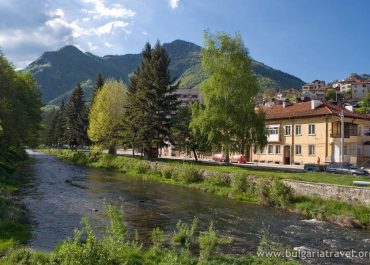
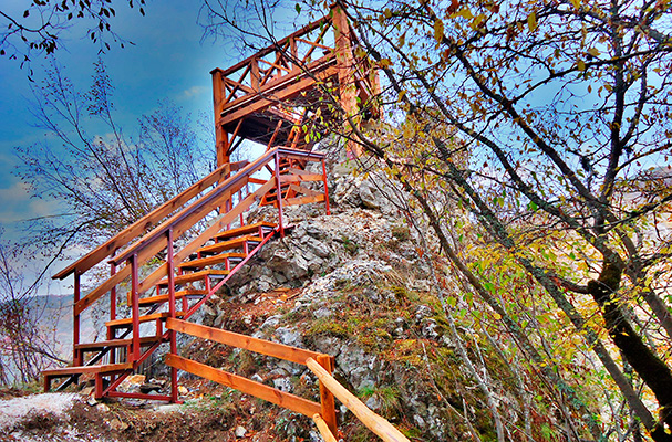
The late antique and medieval fortress near the village of Koshnitsa is located on a conical peak of marbled limestone (1006 m), which in the north-south direction is drilled by a passage cave. It is also a Byzantine castle during its first period of existence and has the military-tactical tasks of the Smolyan fortress, which is located on the route of the Central Trans-Rhodope Road through the Middle Rhodopes.
Archaeological excavations here have registered two periods of operation – I in the VI century and II in the XI-early XIII century. This chronology was confirmed in the study of the preserved fortress chapels in the southern part of the fortress.
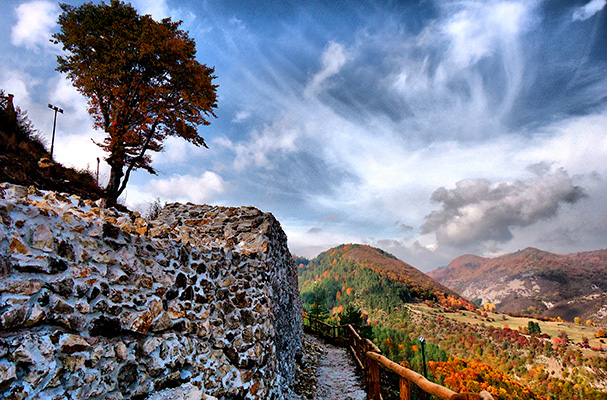
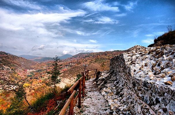
The walls of the fortress are 1.70-1.80 m thick. The construction technique is double-sided masonry, made of crushed limestone mixed with white mortar. The northern and western walls have been discovered. Their total length reaches 80 m. The maximum preserved height of the walls is 3 m. An outer battle tower was discovered at the southern end of the western wall.
Archaeological excavations have found evidence of the use of the peak with the Passage Cave as a rock sanctuary, turned into a fortress during the Eneolithic era (V-IV millennium BC). Prerequisite for this are the favorable natural conditions: a large natural housing shelter with an easily defensible peak for fortification above it and nearby water sources. The cultural strata along the better-preserved northern fortress wall marked several culminations in the use of the peak during the various epochs, most probably related to population migrations, which inevitably led to military conflicts. The analysis of the archeological finds shows a tangible human presence at the top during the Late Eneolithic, the Early and Late Bronze Ages, the Early Iron Age (XI-VI centuries BC), the Thracian-Roman period (I-III centuries), VI centuries and XI-XIII centuries.
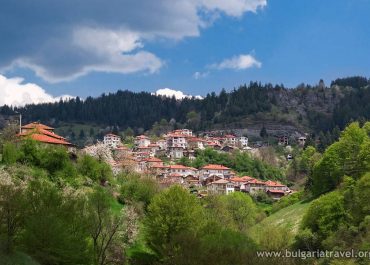
The fortress can be reached by leaving Smolyan on the road to the village of Arda. The villages of Chokmanovo and Smilyan are crossed and half a kilometer before the village of Koshnitsa, to the left of the asphalt road there is an information sign and a dirt road leading to a wooden bridge that crosses the Arda River. After the bridge there are signposts showing the path leading to the top of the fortress. The distance along the trail is about 1 km. and takes about 20-25 minutes of leisurely walking.
Tourist information center – Smolyan
Every day: 8:30-12:00; 12:30-17:00
bul. “Bulgaria” № 5
Tel: +359 301 62530
E-mail: [email protected]
Website: www.smolyan.bg
Presentation
The late antique and medieval fortress near the village of Koshnitsa is located on a conical peak of marbled limestone (1006 m), which in the north-south direction is drilled by a passage cave. It is also a Byzantine castle during its first period of existence and has the military-tactical tasks of the Smolyan fortress, which is located on the route of the Central Trans-Rhodope Road through the Middle Rhodopes.
Archaeological excavations here have registered two periods of operation – I in the VI century and II in the XI-early XIII century. This chronology was confirmed in the study of the preserved fortress chapels in the southern part of the fortress.
The walls of the fortress are 1.70-1.80 m thick. The construction technique is double-sided masonry, made of crushed limestone mixed with white mortar. The northern and western walls have been discovered. Their total length reaches 80 m. The maximum preserved height of the walls is 3 m. An outer battle tower was discovered at the southern end of the western wall.
Archaeological excavations have found evidence of the use of the peak with the Passage Cave as a rock sanctuary, turned into a fortress during the Eneolithic era (V-IV millennium BC). Prerequisite for this are the favorable natural conditions: a large natural housing shelter with an easily defensible peak for fortification above it and nearby water sources. The cultural strata along the better-preserved northern fortress wall marked several culminations in the use of the peak during the various epochs, most probably related to population migrations, which inevitably led to military conflicts. The analysis of the archeological finds shows a tangible human presence at the top during the Late Eneolithic, the Early and Late Bronze Ages, the Early Iron Age (XI-VI centuries BC), the Thracian-Roman period (I-III centuries), VI centuries and XI-XIII centuries.
Work time
How to get there
The fortress can be reached by leaving Smolyan on the road to the village of Arda. The villages of Chokmanovo and Smilyan are crossed and half a kilometer before the village of Koshnitsa, to the left of the asphalt road there is an information sign and a dirt road leading to a wooden bridge that crosses the Arda River. After the bridge there are signposts showing the path leading to the top of the fortress. The distance along the trail is about 1 km. and takes about 20-25 minutes of leisurely walking.
Servising
Practical information
Tourist information center
Tourist information center – Smolyan
Every day: 8:30-12:00; 12:30-17:00
bul. “Bulgaria” № 5
Tel: +359 301 62530
E-mail: [email protected]
Website: www.smolyan.bg
Contacts
Virtual map
Photos
© All images, advertising and video materials and/or other information published on this website are property of the Ministry of Tourism and are protected by the Law on Copyright and Related Rights, according to the Bulgarian laws to all applicable international and relevant acts of the European Union.
