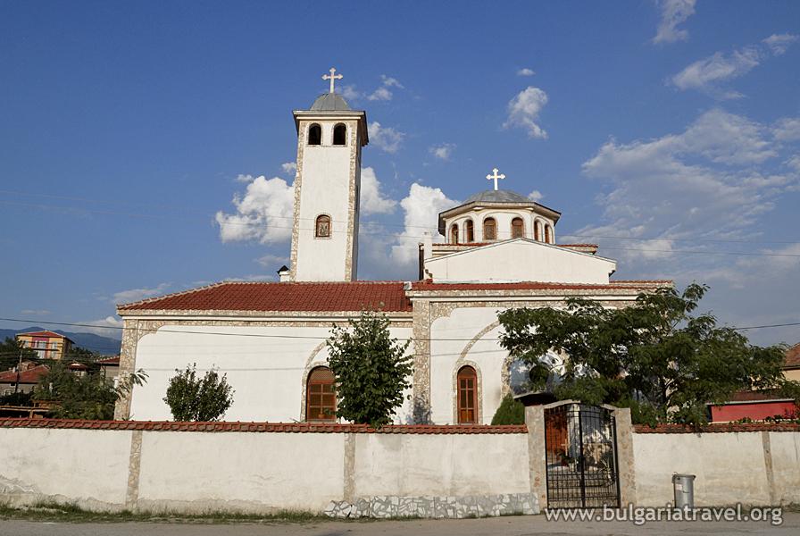
Strumyani
Presentation
Work time
How do we get to
Service
Practical information
Information Center
Contacts
The municipality of Strumyani, by virtue of its territorial manufacturing, territorial servicing functions and the level of building of the network to the populated places, is a forming and open municipality. The center of the system is the village of Strumyani.
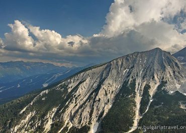
The territory of the municipality covers the eastern slopes of Malashevska mountain, the valley of the Struma river and a very small part of the western Pirin mountain. The terrain is generally looking southeast, but the folds of the mountain introduce diversity into the exposition. The eastern slopes of the Malashevska mountain are greatly undulating and crossed by multiple deeply cut rivers, ravines, dry valleys, etc. The highest point in this region is the Bukata peak /1,571 m altitude/. The Pirin section of the settlement system begins to the east of the Struma river with slopes of steep heads. The highest point in this region is Sharaliya peak /2,171 m altitude/.
The municipality of Strumyani borders to the north with the municipality of Kresna, to the south with the municipality of Sandanski, to the east with the municipality of Bansko, to the southwest with the municipality of Petrich and to the west with our border with the Republic of North Macedonia. It is located on an area of 362 square meters and has 6,800 residents.
The relief in its larger part is mountainous /Pirin and Malashevska mountain/ and occupies about 80% of the territory of the municipality of Strumyani. The rest of the lands, about 20%, are along the valley of the Struma river and the end slopes of the two mountains. These lands have a high degree of assimilation and great importance for the development of agriculture, which determines the larger density of the population and the economic functions of the municipality. The western part of the settlement system is entirely occupied by Malashevska mountain. It occupies about ¾ of its area. The main ridge of the mountain is almost parallel to the Struma river and rises from south to north. It has well-expressed river terraces, as almost all of them are agricultural lands. The eastern part of the municipality is entirely occupied by the Pirin mountain. From 100 meters in its lowest parts along the Struma river, the relief acquires alpine nature reaching 2,400 meters altitude in the northern Pirin.
Website: https://www.strumyani.org/
Presentation
The municipality of Strumyani, by virtue of its territorial manufacturing, territorial servicing functions and the level of building of the network to the populated places, is a forming and open municipality. The center of the system is the village of Strumyani.
The territory of the municipality covers the eastern slopes of Malashevska mountain, the valley of the Struma river and a very small part of the western Pirin mountain. The terrain is generally looking southeast, but the folds of the mountain introduce diversity into the exposition. The eastern slopes of the Malashevska mountain are greatly undulating and crossed by multiple deeply cut rivers, ravines, dry valleys, etc. The highest point in this region is the Bukata peak /1,571 m altitude/. The Pirin section of the settlement system begins to the east of the Struma river with slopes of steep heads. The highest point in this region is Sharaliya peak /2,171 m altitude/.
The municipality of Strumyani borders to the north with the municipality of Kresna, to the south with the municipality of Sandanski, to the east with the municipality of Bansko, to the southwest with the municipality of Petrich and to the west with our border with the Republic of North Macedonia. It is located on an area of 362 square meters and has 6,800 residents.
The relief in its larger part is mountainous /Pirin and Malashevska mountain/ and occupies about 80% of the territory of the municipality of Strumyani. The rest of the lands, about 20%, are along the valley of the Struma river and the end slopes of the two mountains. These lands have a high degree of assimilation and great importance for the development of agriculture, which determines the larger density of the population and the economic functions of the municipality. The western part of the settlement system is entirely occupied by Malashevska mountain. It occupies about ¾ of its area. The main ridge of the mountain is almost parallel to the Struma river and rises from south to north. It has well-expressed river terraces, as almost all of them are agricultural lands. The eastern part of the municipality is entirely occupied by the Pirin mountain. From 100 meters in its lowest parts along the Struma river, the relief acquires alpine nature reaching 2,400 meters altitude in the northern Pirin.
Work time
How to get there
Servising
Practical information
Tourist information center
Contacts
Website: https://www.strumyani.org/
Virtual map
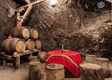
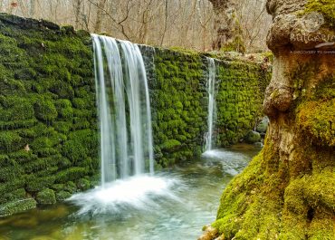
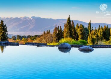
Photos
© All images, advertising and video materials and/or other information published on this website are property of the Ministry of Tourism and are protected by the Law on Copyright and Related Rights, according to the Bulgarian laws to all applicable international and relevant acts of the European Union.