Blagoevgrad
Presentation
Work time
How do we get to
Service
Practical information
Information Center
Contacts
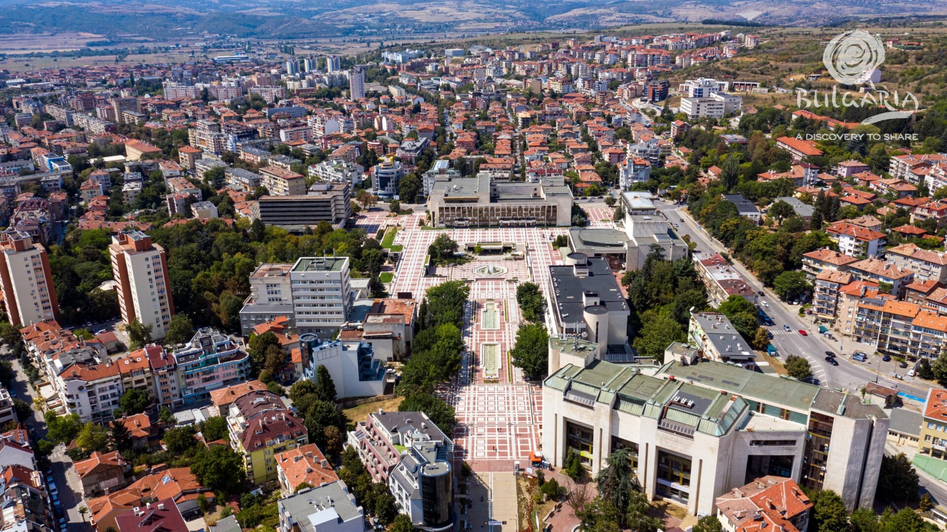
Blagoevgrad is located in Southwest Bulgaria, at a distance of about 100 km from Sofia, in the so-called Blagoevgrad valley, on an altitude of 410 meters.
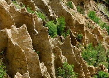
The town is situated in close proximity to the southwest slopes of Rila Mountain, in the river valleys of Struma and Blagoevgradska Bistritsa.
The foot of Vlahina Mountain can be seen to the west of it. The territory of the town in regional scale is located in the westernmost part of the Rila-Rhodope Massif. The average temperature is +14 degrees, which determines the region as one of the warmest in the country.
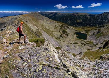
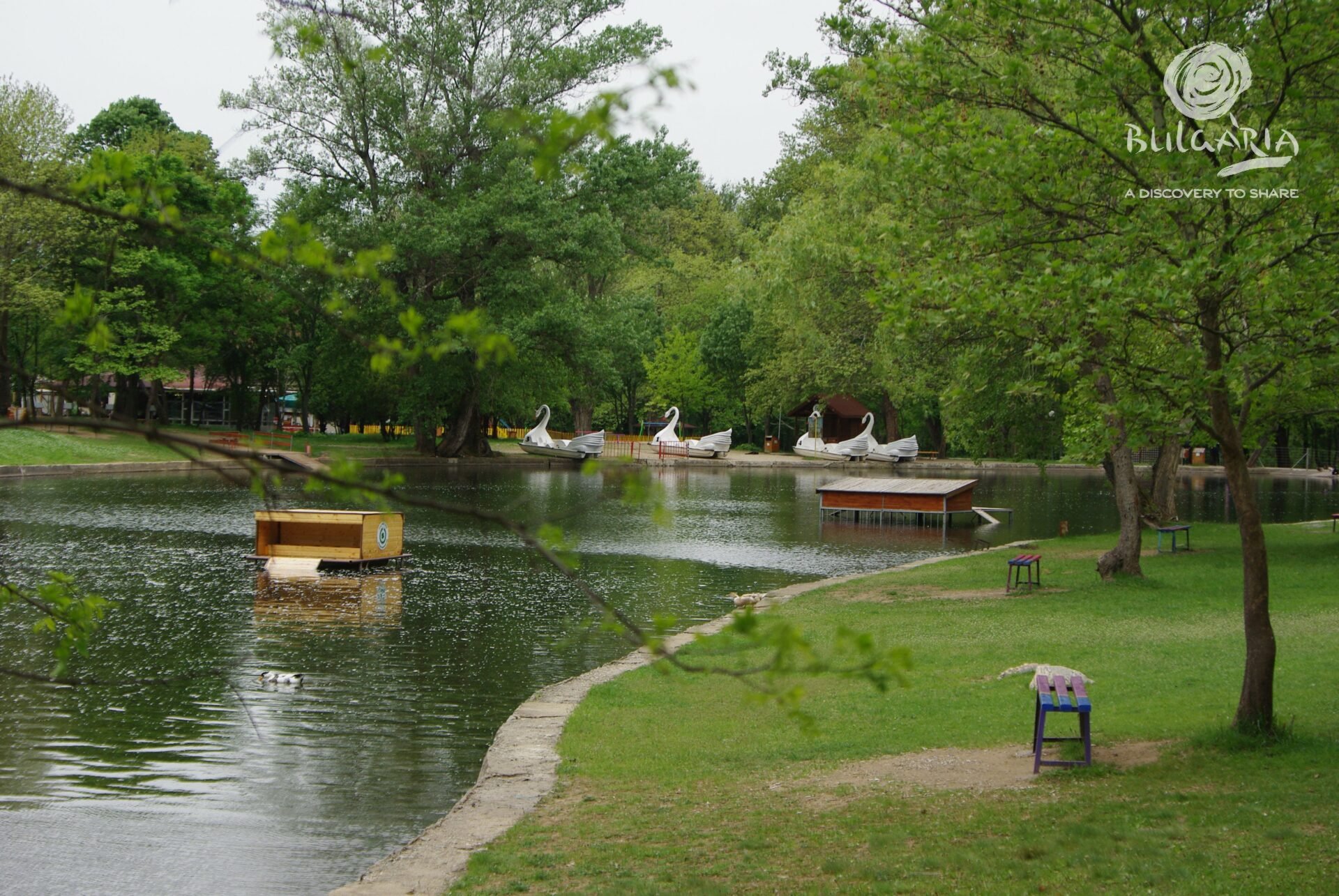
Blagoevgrad is a starting point for the Rila Monastery, as well as for the charming museum town of Melnik. This is also a starting point for the tourist routes leading to the beautiful mountains Rila and Pirin.
Blagoevgrad is presently a municipal center with a rich history. Traces of habitation by humans dating back to the Neolithic Age have been found in Blagoevgrad. The favorable conditions contributed to the arising Thracian civilization in this area around the 3rd century BC. The hot mineral springs became a center of the Thracian settlement, to which the Roman conquerors later headed. The name of the town of that time is also known – Skaptopara (Upper Market Area), which is related to the Thracian tribe Dentelets, which inhabited the upper current of the river Struma. Around the 1st century AD, the Thracians were conquered by the Romans.
With the arrival of the Slavs, life here flourished. They settled in these places during the 6th-7th century. The lands were later joined to the Bulgarian state during the ruling of Khan Presiyan (836 – 852). The falling of Bulgaria under the Ottoman Dominion interrupted for nearly five centuries the constructive attempts of the local population. At the end of the 15th century, the present town was established. It was mentioned for the first time in a Turkish document dating back to 1502 under the name of Gorna Dzhumaya. After the Ottoman Dominion, since the 15th century, the town has changed its name multiple times – Dyuma Bazari, Dyuma, Orta Dyuma, Dzhumaya, Gorna Dzhumaya. But regardless of the way it was called, multiple Muslims were residing here. The entire Islamic army was concentrated here. The name Dzhumaya means Friday. Friday was the day for holiday prayer of Muslims, and hence – market day. There is a legend about the Christian population of this area, which speaks about a villager who brought his ill horse here, and the horse was cured by the mineral springs.
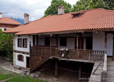
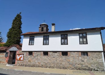
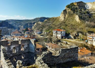
During the Age of Revival, the Varosha area was constructed in the eastern part. This was the Bulgarian neighborhood of the town. The residents of Dzhumaya obtained a Sultan’s decree for building a church. This way the church “Presentation of the Blessed Virgin“ was consecrated in 1844 in Varosha, and in the next 50 years it was completed and painted. The house of Georgi Izmirliev – the Macedonian boy who participated in the Liberation Movements – is also located in Varosha.
Tourist information center- Blagoevgrad
Monday to Friday from 10:00 to 13:30; from 14:30 to 19:00
“Georgi Izmirliev-Makedonche” 7, Blagoevgrad
Tel: +359 884 115150
E-mail: infocentreblg@gmail.com
Website: http://www.viewblagoevgrad.com/
Presentation
Blagoevgrad is located in Southwest Bulgaria, at a distance of about 100 km from Sofia, in the so-called Blagoevgrad valley, on an altitude of 410 meters.
The town is situated in close proximity to the southwest slopes of Rila Mountain, in the river valleys of Struma and Blagoevgradska Bistritsa.
The foot of Vlahina Mountain can be seen to the west of it. The territory of the town in regional scale is located in the westernmost part of the Rila-Rhodope Massif. The average temperature is +14 degrees, which determines the region as one of the warmest in the country.
Blagoevgrad is a starting point for the Rila Monastery, as well as for the charming museum town of Melnik. This is also a starting point for the tourist routes leading to the beautiful mountains Rila and Pirin.
Blagoevgrad is presently a municipal center with a rich history. Traces of habitation by humans dating back to the Neolithic Age have been found in Blagoevgrad. The favorable conditions contributed to the arising Thracian civilization in this area around the 3rd century BC. The hot mineral springs became a center of the Thracian settlement, to which the Roman conquerors later headed. The name of the town of that time is also known – Skaptopara (Upper Market Area), which is related to the Thracian tribe Dentelets, which inhabited the upper current of the river Struma. Around the 1st century AD, the Thracians were conquered by the Romans.
With the arrival of the Slavs, life here flourished. They settled in these places during the 6th-7th century. The lands were later joined to the Bulgarian state during the ruling of Khan Presiyan (836 – 852). The falling of Bulgaria under the Ottoman Dominion interrupted for nearly five centuries the constructive attempts of the local population. At the end of the 15th century, the present town was established. It was mentioned for the first time in a Turkish document dating back to 1502 under the name of Gorna Dzhumaya. After the Ottoman Dominion, since the 15th century, the town has changed its name multiple times – Dyuma Bazari, Dyuma, Orta Dyuma, Dzhumaya, Gorna Dzhumaya. But regardless of the way it was called, multiple Muslims were residing here. The entire Islamic army was concentrated here. The name Dzhumaya means Friday. Friday was the day for holiday prayer of Muslims, and hence – market day. There is a legend about the Christian population of this area, which speaks about a villager who brought his ill horse here, and the horse was cured by the mineral springs.
During the Age of Revival, the Varosha area was constructed in the eastern part. This was the Bulgarian neighborhood of the town. The residents of Dzhumaya obtained a Sultan’s decree for building a church. This way the church “Presentation of the Blessed Virgin“ was consecrated in 1844 in Varosha, and in the next 50 years it was completed and painted. The house of Georgi Izmirliev – the Macedonian boy who participated in the Liberation Movements – is also located in Varosha.
Work time
How to get there
Servising
Practical information
Tourist information center
Tourist information center- Blagoevgrad
Monday to Friday from 10:00 to 13:30; from 14:30 to 19:00
“Georgi Izmirliev-Makedonche” 7, Blagoevgrad
Tel: +359 884 115150
E-mail: infocentreblg@gmail.com
Website: http://www.viewblagoevgrad.com/
Contacts
Virtual map
Photos
© All images, advertising and video materials and/or other information published on this website are property of the Ministry of Tourism and are protected by the Law on Copyright and Related Rights, according to the Bulgarian laws to all applicable international and relevant acts of the European Union.